
Wind Chill Watch issued in Kansas City as arctic blasts bring powerful, strong winds and basement-level temps
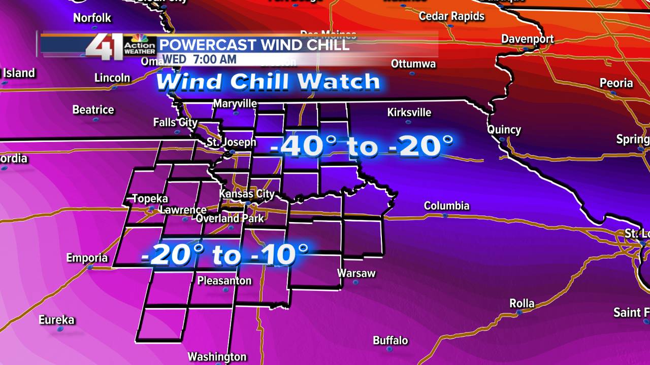
Photo from Jeff Penner, 41 Action News
An arctic front blew through Kansas City this morning on the power of 50-55 mph wind gusts. The rest of today and tonight will see the wind decrease as temps drop to 10°-15° tonight. The second front arrives Tuesday around noon.
The polar vortex is a swirling area of winds in the upper atmosphere that is a persistent and typically a stronger feature of the winter months (it’s weaker in the summer months but still there). It’s located up towards the polar regions in the northern hemisphere. It more or less remains in a steady state up there and the circulation of it typically bottles up the REALLY nasty cold air for weeks at a time… [source.]
Gary Lezak said this morning in his blog, “We are moving into the part of the cycling pattern that produced the second snowiest November on record in KC, and one of the coldest Novembers on record as well. We will be getting the late January and February version of the LRC in this third cycle, and the question will be: How cold and snowy will it be in this cycle? In the the second cycle, this part of the pattern didn’t have the cold air to work with, but that is not the case this time.”
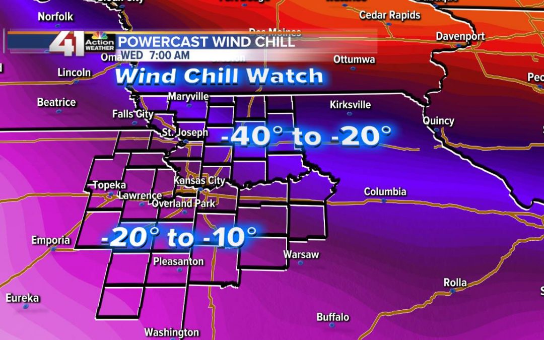
The weather coming Tuesday night into Wednesday night will have a record-breaking Arctic blast that will impact areas northeast of KC from North Dakota southeast to Indianapolis a bit stronger than what we will experience farther southwest. Just look at this forecast wind chill map above. Minneapolis will be taking the brunt of the cold – -60° wind chill! That is dangerous Arctic cold.
Most important during such extreme conditions is to bundle up in LAYERS as opposed to a single thick jacket. The layers create pockets of air which warm up and keep your body warm much better than one layer.
The National Weather Service has even advised not to take deep breaths outside and minimize talking. We don’t think that will be much of a problem as the winds are so strong, you’ll just be trying not to blow away!
DO stay safe, warm and inside when possible during this extremely cold weather!
Getting to school and work
Everyone should try to stay inside this week, even if that means working or completing class assignments from home.
If you use public transit to commute, keep moving at bus and metro stops by pacing or jumping up and down. If you drive, make sure you have a flashlight with fresh batteries in your car, as well as a full tank of gas.
Know the signs of hypothermia and frostbite
Be ready to recognize the signs of cold-related conditions such as hypothermia and frostbite. Even if you are inside, if you notice your skin turning blue or gray, or you experience extreme fatigue and shivering, you should warm up right away.
It can take fewer than 15 minutes for the first signs of hypothermia and frostbite to set in.